
Golf Course Management
Using drone technology to manage your golf course can save thousands of dollars in chemical applications by targeting troublesome areas. Not only does this save money and time but is much better for the environment. NDVI enables your superintendent and turf management team the data needed to maximize your team's efforts in keeping your beautiful course in excellent shape.

TURF STRESS MANAGEMENT
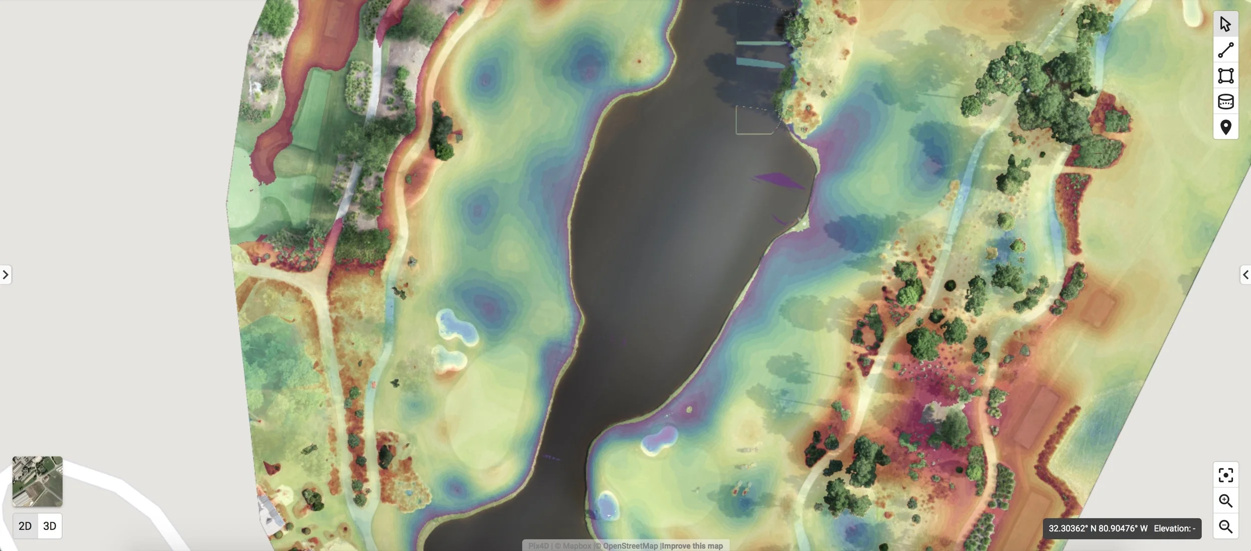
Using NDVI analysis and data, your turf team can now identify areas that are beginning to show signs of stress before the naked eye can visualize stress or disease. Ground truthing, by taking soil and/or tissue samples will enable your turf team to target applications based on need conserving chemicals and protecting the environment
These preventative measures will produce significant benefits to the health of your turf and to your members before serious harm has occurred.
Scouting
Using aerial imagery and NDVI maps, courses can significantly reduce the amount of time your maintenance team spends on scouting. The entire course can now be scouted indoors with targeted scouting being completed based on geolocated "target/watch areas" and scheduled to individual crew members via our mobile task management application.
It's time to work smarter, not harder!
MAP KEY COURSE FEATURES
Produce current maps, elevation/contour maps and 3D renderings, allowing superintendents to see overall course health and areas of turf stress. Track renovation projects, redesigns and other course constructions projects.
Superintendents and maintenance crews can monitor course features, equipment, and areas of interest including overlaying high resolution map with TORO irrigation maps and soon to be integration with soil moisture meters.
Capitalize on the power and efficiencies of software integration!